Rauriser Valleys
Rauris
Peaks and crossings
- Silberpfennig (2.600 m)
- Herzog-Ernst-Spitze (2.933 m)
- Hoher Sonnblick (3.106 m)
- Hocharn (3.254 m)
- Ritterkopf (3.006 m)
- Edlenkopf (2.923 m)
- Hinteres Modereck (2.930 m)
- Baumgartlkopf (2.623 m)
- Breitebenekopf (2.236 m)
- via Riffelscharte (2.472 m) - Niedersachsenhaus
- via Fraganter Scharte (2.754 m) to the Duisburger Hütte (2.573 m)
- via Obere Brettscharte (2.786 m) into the Zirknitztal
- via Weißenbachscharte (2.645 m) to Heiligenblut
- via Mittertörl (2.373m) to the Glocknerstraße
- via Hochtor (2.926 m) to the Glocknerstraße
Valley of Vultures

Valley of Vultures
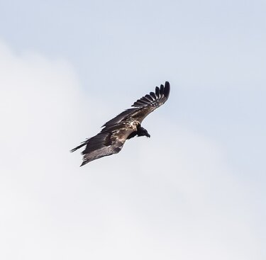
In Rauris up to 100 griffon vultures regularly make their home between May and September. The HohenTauern is the only region in Central Europe where griffon vultures can regularly be observed in the wild. They are nonbreeding and young birds from the breeding areas of the northwest Balkan Peninsula. Notable roosting cliffs here can be found in Rauriser Krumltal, in Hollersbachtal and in Stubachtal valleys. Rauris was also the place for the first release of a bearded vulture into the wild. These beautiful animals were almost completely extinct in Europe in the 19th century. They were rumoured to be poaching lambs and children, even though they are specialised bone eaters. Thanks to intense breeding programmes in zoos, reintroduction of these fine birds could begin in 1986. To date, three couples have been found in the Hohe Tauern. Researchers are hoping for successful breeding so that an "Austrian" bearded vulture will soon circle the skies.
Transhumance and trading by pack animals
The Rauris Valley is one of the Tauern valleys with the most alpine pastures. Around 10 % of the community area is used for agriculture, half of which is alpine pasture area. Transhumance in Rauris valley, alongside Fuscher, Felber- and Amertal, Stubach- and Hollersbachtal valleys in the northern Hohe Hohen Tauern is of the most significance. Moreover, in Rauris you can also see plenty of horse driving, including the Pinzgau Noriker horse. The Rauriser Tauern (Hochtor) was used very early on for crossing the Alps. Excavations on the Maschlalm (around 400 BC) and in Rauris date back to 2000 BC. "Rurise" was first mentioned in documents in 1122. Wörth was known as an important reloading point for mule and vehicle traffic as early as in 1230. The Rauriser Tauernhaus provided shelter for travellers and traders and is still used a s a rest stop to this day.
Gold mining
Rauris, just like Bramberg and Hüttschlag, is a very old mining village with its economic heyday. Back then, around 2,000 miners and 30 guilds are said to have been active in Rauris and Gastein alone. The guild houses with their keel arch portals and bays bear witness to the prosperity in these times. The significance of mining diminished more and more and at the start of the 20th century was stopped completely. Today, blocks from a rockfall are commercially processed in the quarries of Bucheben under the name of "Rauriser Plattengneis". In Kolm- Saigurn, tourists can try their hand at gold panning.
Weather station - Observatory Hoher Sonnblick

Weather station - Observatory Hoher Sonnblick
Built by Ignaz Rojacher in 1886, the meteorological station on the Hohe Sonnenblick is considered the the most successful high altitude observatory in the world. The station is manned all year round and in addition to weather services also performs duties for climate and glacier research (see "read more"). In the last 150 years, temperatures in the Alpine region have increased by 1.5°C. The glaciers are shrinking. The permafrost base is rising and rocks and boulder are becoming unstable. The weathers station itself is affected by this as it's very exposed on the rock summit of the Hohe Sonnenblick, which was redeveloped with much effort so as to save the Zittelhaus and observatory from falling.
Virgin forest
Because of deforestation from mining in the past, Rauris valley is relatively sparsely wooded. Yet still we can find primeval forest here, which is quite pristine. The Rauris virgin forest or Durchgangswald is an archaic boulder forest with numerous moor ponds in the rearmost Hüttwinkltal valley. It grows at between 1,650 and 1,750 m altitude on an old landslide area with numerous swampy ponds and puddles. Columnar crown spruce, giant Swiss pine and beautiful snag trees are signs of a living forest. Between Kruml- and Seidlwinkltal vallyes lies a beautiful mixed forest. A waterfall plunges down three levels here. The area is not developed with any roads or trails and thus provides an undisturbed reserve for black and wood grouse.
Seidlwinkltal - On the trails of pack mules
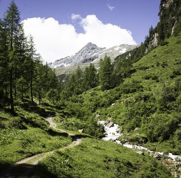
The trek into Seidlwinkltal to the Rauriser Tauernhaus begins at Prässerhäusl (bus) or at the Fleckweide parking lot 6 km from Wörth. It leads through varying valley scenery with ravine forest, alpine pastures, past waterfalls (e.g. Spritzbach curtain falls) until you reach the Tauernhaus at 1,527 m altitude. A hike through rear Seidlwinkltal to the Grossglockner High Alpine Road is recommendable. Past the Litzlhofalm across alpine meadows to Mittertörl (side trip to Elendgrube – geological information) and follow the road to Fuscher Lacke Inn (2,261 m).
Walking time: approx. 2 ½ hours to Tauernhaus, continue to Fuscher Lacke approx. 3 hours, climb down around 4 hours
Krumltal - Vulture roosting cliff
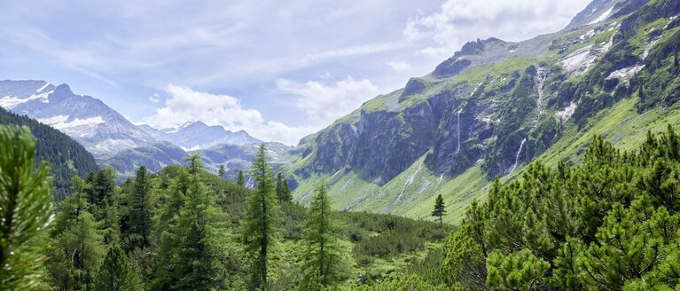
From Lechnerhäusl Inn, the trek leads along easy paths to the Bräualm hut. Continue across a valley step to Rohrmoser Alm and the waterfall at the head of the valley. Climbers walk to the Otto-Umlauft-bivouac by the NW-ridge of Hocharn mountain. Steep rocky slopes soar upwards in the outer region of the valley. This griffon vulture roosting cliff in Rauris Krumltal is a meeting point for the feathered summer guests. It can be recognised by the white strips of droppings, on which rust-red crustose lichen grow. That's where the name Rotwand (red wall) comes from. Here 30 – 40 griffon vultures can often be seen roosting. Bearded vultures are also a common sight in Krumltal. Don't forget your binoculars!
Walking time: approx. 2 hours to Bräualm, another 1 ½ hours to Rohrmoser Alm, ½ hours to waterfall. A total of 6 hours to the bivouac.
Hüttwinkltal - Nature Trail Rauris Virgin Forest
The nature trail set up by the nature preservation union leads through the so-called Rauris virgin forest, an archetypical boulder forest. 13 information boards and a small forest museum explain the special features. Route: The dirt road to the Durchgangsalmen transit lodges leads to the nature trail, taking you through the forest in one loop. Return to Kolm Saigurn or via the Filzen-, Seealm, Mitterastenalm, then a steep drop downhill to the Astenschmiede lodge and Bodenhaus inn.
Walking time: Nature trail approx. 1 hour, descent via Mitterastenalm approx. 2 ½ hours.
.


