Habachtal
Bramberg
Peaks and crossings
- Hohe Fürleg (3.243 m)
- Plattiger Habach (3.207 m)
- Schwarzkopf (2.996 m)
- Kratzenberg (3.022 m)
- Larmkogel (3.017 m)
- via Larmkogelscharte (2.933 m) to the Neuen Fürther Hütte
- via Schwarzkopfscharte (2.861 m) to the Neuen Prager Hütte
- via Habachscharte (2.915 m) to East Tyrol
Valley of Emeralds

Valley of Emeralds
The Habachtal is world-famous for its mineral wealth. In particular, the finds of emeralds from the Leckbach Gully, but also, for example, pyrites, actinolite, magnetite octahedra, aquamarine and tourmaline as well as other minerals attract collectors to the picturesque Tauern Valley year after year. Interesting finds are made again and again. The emerald mine in the Leckbach Gully is the only relevant emerald deposit in Europe. The mine is privately owned and not open to the public. In the immediate vicinity, other mineral finds have been made in classic alpine fissures, such as smoky quartz from the Wiesbach Gully, rock crystal from the Teufelsmühle and prehnite in the valley head. Legal regulations govern mineral extraction in the Hohe Tauern National Park.
Geology - a look at the earth's past
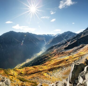
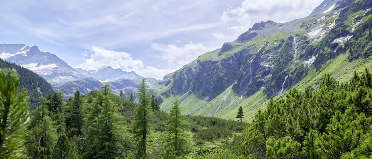
In the Habachtal, decades of painstaking detailed work have gone into researching the formation of the mountains. Today, the rocks of the valley tell us the vivid story of the uplift, folding, shaping and erosion of the Hohe Tauern. An entire rock formation - the Habach Formation - is named after the valley. These are rocks that are 600 to 400 million years old and are thus among the oldest in the Hohe Tauern. These rocks are located in the northern section of the Habach Valley (Habachklause to Wennser Grundalm). A glacier pot and a magnificent glacier gully lie halfway between Habachklause and Windbachbrücke. They bear witness to the formation of the landscape by the glaciers that filled the Tauern valleys until 15,000 years ago. After their retreat, U-shaped valleys remained. The rear Habachtal shows this classic valley shape. Erosion, landslides and sliding slopes further altered the valleys. The Habachklause is an example where slippery black phyllite pushed the valley closed and a narrow valley was formed. In the valley area there are many, slightly radioactive springs (e.g. Krameralm). The waterfall at the head of the valley can be seen from far away.
Mineral Museum Bramberg
The local history and mineral museum in Bramberg shows the diversity and richness of the minerals of the Habachtal in a unique display. More than 500 exhibits from the region are presented in a lovingly restored Pinzgau farmhouse from the 14th century. In addition, there is an exhibition on rural crafts, beekeeping, customs and religious art.
Smaragdwanderweg in the Habachtal

Smaragdwanderweg in the Habachtal
On the hike through this beautiful Tauern valley, information boards explain the geological conditions and the wealth of rocks found here. The history of the development of the Hohe Tauern up to the micro-world of the rocks is explained. The Emerald Trail begins at the Habachtal car park. After about an hour's hike, the Habachtal opens up to a particularly striking trough shape created by glaciers. The end of the trail is in the area of the Moa Alm.
Walking time: Car park to Moa Alm approx. 2 ½ hours.
Searching for emeralds under the Leckbach draw
A path leads from the Alpenrose Inn to the Leckbach Gully. This is the location of the emerald deposit in the Habach valley. Erosion, especially a large mudflow in '02 and further landslides have transported emerald-bearing rock and emeralds down to the valley area. The emerald mine in the upper part of the Leckbach Gully is not accessible. In addition, this part of the gully is very prone to rockfall and it is not recommended to climb up there.
Walking time: Car park to GH Alpenrose in approx. 2 hours.
Hike to the Karsee
On the northern edge between the Habach and Hollersbach valleys lies the Karsee (2,082 m) in a beautiful location. The starting point of the hike is the Bramberg district of Wenns. The trail leads through spruce forest up to the Kargrundalm (1,592 m), further through dwarf shrubbery (alpine roses) and larch and Swiss stone pine forest to the Karhochalm. The Karsee is 330 m long and 145 m wide and has a depth of up to 20 metres. Hikers of good physical condition can reach the Zwölferkogel (2,281 m) in half an hour, or the Breitkopf (2,421 m) to the south in about 1 hour.
Walking time: approx. 4 hours, from there ½ hour to the Zwölferkogel.
Summit meeting Larmkogel
From the Moa Alm you reach the summit of the high Larmkogel (3,022 m) via the Thüringer Hütte and then descend into the Hollersbachtal valley to the Kratzenbergsee lake. After a short rest at the Fürtherhütte, you descend to the Ofner Boden. The valley taxi takes you back to Bramberg. This wonderful mountain hike can be done with a National Park attendant. Information on this is available from the National Park authorities.


