Fuschertal
Fusch an der Glocknerstraße
Peaks and crossings
- Imbachhorn (2.470 m)
- Hoher Tenn (3.368 m)
- Gr. Wiesbachhorn (3.564 m)
- Klockerin (3.425 m)
- Großer Bärenkopf (3.396 m)
- Breitkopf (3.154 m)
- Fuscherkarkopf (3.331 m)
- Sinwelleck (3.261 m)
- Brennkogel (3.018 m)
- Schwarzkopf (2.765 m)
- Großglockner (3.798 m)
- via Brandlscharte (2.371 m) into the Kaprunertal
- via Bratschenkopfscharte (3.401 m) to the Heinrich-Schwaiger-Haus
- via Gruberscharte (3.092 m) – Gruberschartenbiwak
- via Bockkarscharte (3.039 m) to the Oberwalderhütte
- via Untere Pfandlscharte (2.663 m) to the Glocknerhaus
- via Mittertörl (2.373 m) to the Rauriser Tauernhaus
- via Hochtor (2.926 m) to Heiligenblut
Deep Valley

Deep Valley
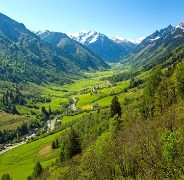
The 20 km long Fuschertal rises only gradually, only in the middle - the Bärenschlucht - does the Fuscher Ache overcome a 250 m high escarpment of limestone mica schist. The inner Fuschertal (Ferleitental) is the deepest trough valley in the Eastern Alps: It is still around 2,400 metres in altitude to the summit of the Wiesbachhorn - an impressive valley head framed by glacier-covered three-thousand-metre peaks.
Gorgeous glaciers
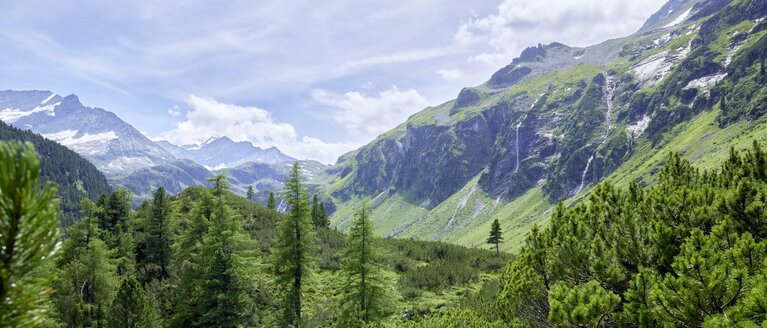
The landscape in inner Fuschertal is characterised by numerous glaciers. The Bockkarkees is a genuine kettle glacier with a frayed snout and is the largest glacier in the valley. Icefalls thunder down into the valley time and again. The biggest was in 1945, when ice avalanches plunged into Rotmoos. The Teufelsmühlkees glacier between Hintere Bratschenkopf and Grosse Wiesbachhorn feeds the lowest situated glacier of the Hohe Tauern, the Boggeneikees. The glaciers receded significantly, as many years of research in the national park verify. The longest glacier in the Hohe Tauern National Park is definitely the Pasterze at the foot of the Grossglockner with a lenght of 5 km from the glacier snout to the Hufeisenbruch glacial fracture or 7 km from the glacier snout up to the Johannisberg mountain (as of 2008). Until the 90s, the Pasterze was losing roughly 1.7 metres in height annually. In the hot year that was 2003, a whole 6.5 metres. Since then the ice is melting ever faster.
Tauern - Bronze Age to now
The short link via the Hochtor into Mölltal made the Tauernweg trail interesting as early as in the Bronze Age. The Römerweg (Roman Trail) is a medieval path for gold mining and freight hauling with horses. Remnants can be found in several locations such as between Fuschertörl and Hochtor. Today, the Grossglockner High alpine Road (toll road) leads through the alpine terrain all the way to Heiligenblut in summer.
Rotmoos - international nature reserve

Rotmoos - international nature reserve
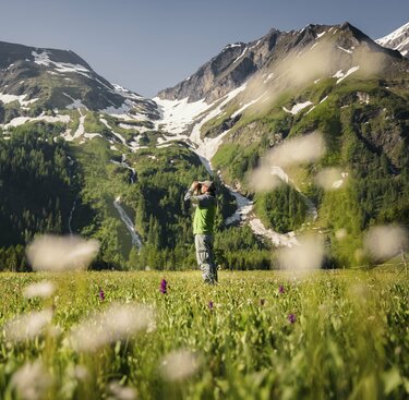
The Rotmoos in Fusch Valley is one of the most significant wetlands in the state of Salzburg. It covers around 58 ha and is located in the head of the valley at an altitude of 1,250 - 1,300 m. The Rotmoos is a silicate-limestone low moor, a rare type of moor in the Hohe Tauern. The natural network of channels, open gravel banks and moor grass make it a true natural gem. The red colour comes from the iron-red mud silt which settles in the slow moving and stagnant waters. The moor has been a Ramsar nature reserve since 1995, and as such is recognised as an "internationally important wetland". It is rich in orchids and rare moor plants, including the western marsh orchid – an orchid which flowers in the thousands especially in early summer and thus makes for an unforgettable impression. That's why inner Fuscherta is also known as the "Valley of Orchids". Alpine species interlock with the moor vegetation. This is also where stockades piled up from rocks provide a habitat for various animals.
Special nature protection area Piffkar
A mosaic of plants and diverse fauna characterise the Piffkar. Here acid and chalky soil alternate in a very confined space. The rusty-leaved alprose grows next to the hairy alpine rose. Numerous insects such as bumblebees and butterflies visit the alpine flowers. The bearded vulture sweeps down closely over the Piffschneid. Raven and golden eagles can be frequently observed. Nature is left to its own devices here and the development scientifically studied. A hike to the Baumgartlkopf summit provides insights into thos magnificent special nature protection area.
Edelweiss and golden eagles - A hike to the Gleitwitzer Hut
From Fusch to the Hirzbach falls (Trail no. 725) therough wonderful ravine forests you can reach the Hirzbachalm alpine pasture in around 2 hours. From here, the trail leads across sunny alpine meadows full of flowers to the Gleitwitzer hut with wonderful views. With some luck you can see golden eagles that roost nearby. Further to the north to the Brandlscharte and up to Imbachhorn, one of the many wonderful panoramic mounatins in the Hohe Tauern.
Walking time: approx. 3.5 hours to the hut, approx. 1 hour up to the Imbachhorn mountain.
Weichselbachtal - Walchen Grundalm hut
The trail leads along the Bad Fuscher road slightly uphill across several bridges 2 km to the south, then to the east into Weichselbachtal valley. In the old health resort of Bad Fusch, follow the slightly rising alpine path after the church, past the healing springs into the idyllic scenery of Weichselbachtal valley with velvety alpine meadows, peaceful forests and rushing mountain streams. At the head of the valley you'll find the Walchen Grundalm (1,436 m), from where those who know the way can walk to the Weichselbachhöhe – Wetterkreuz (2,218 m) to Rauris-Wörth (6 hours).
Walking time: approx. 3 hours (Trail no. 2), crossing to Wörth not well signposted.
Water Adventure Walcher Waterfall
Starting at the Tauerngasthof Inn in Ferleiten, cross the bridge and follow the sign for "Wassererlebnisweg Walcheralm". After hiking for around 2 hours you'l get to the trail through the waterfall at 1,731 m above sea level. The mass of water drops down to the valley right before visitors' eyes. Guided hikes are offered in summer.
Walking time: approx. 2 hours
Hike to Schwarzenberghütte lodge
The three and a half hour long climb along torrents, across alpine meadows and past waterfalls to the Schwarzenberghütte lodge can be completed by all hikers in normal conditions. Easy tours from the lodge lead up to the 2,520 m high Steinkarl and the glacier panoramic trail goes up all the way to the edge of Hochgrubenkees glacier.
The lodge's local mountain, the Hohe Dock, requires a certain degree of surefootedness and alpine experience as well as appropriate gear. This incidentally goes for all tours to and around the Schwarzenberghütte lodge. Tours up to the Grosse Wiesbachhorn, Grosse Bärenkopf and Klockerin are high alpine glacier tours and only recommended for climbers with appropriate gear and experience. All other peaks provide breathtaking panoramic views of the highest summits in the Eastern Alps and the largest glaciers in Austria.
Walking time: approx. 3 ½ hours to the hut, 1 ½ hours to the glacier forefield (surefootedness required here).
Marsh orchids and Steinhag - A hike into Rotmoos moor
Starting point is the Ferleiten toll booth, from where you cross the Fuscher Ache river and continue south on a dirt road to the turnoff for Trauneralm. From here the Rormoos extends all the way into the head of the valley. You can still get into the wild and romantic Käfertal high valley away from any paths and tracks. However, the innermost regions should be avoided due to danger from falling ice. Easy hikes on flat terrain, suitable especially for families. For mountain hikers there's a trail through beautiful montane and subalpine forest leading up to the Trauneralm hut along some sharp bends. The hut used to be a base for crossings along the Pfandlscharte to Glocknerhaus.
Walking time: approx 1 hour to the Rotmoos, approx 1 hour for exploring the moor, about 1 ½ hours from the fork to the Trauneralm.


